-
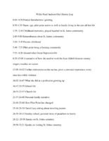 Oral history log of Willie Pearl Jackson's interview
 A log detailing the times and topics discussed in her interview.
-
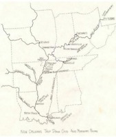 Six Months from Tennessee River Map
 Map shows the navigable rivers by which explorers migrated south prior to established trails which ran directly to North Texas.
-
 St. John's Cemetery Map
 This is a map of St. John's Cemetery. It marks the location of all known headstones in the cemetery.
-
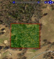
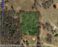 Aerial View of St. John's Cemetery
 This is a satellite image of the plot of land on which the cemetery is located.
-
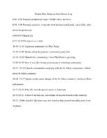 Oral history log of Pearlie Mae Simpson's interview
 A log detailing the times and topics discussed in her interview.
-
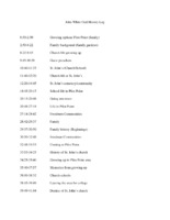 Oral history log of John White's interview
 A log detailing the times and topics Dr. White discussed in his interview.
-
 Oral history log of Willie Hudspeth's interview
 A log detailing the time and topics Willie Hudspeth discussed in his interview.
-
 Oral history interview of John White
 Interview of John White, a native of Pilot Point.
-
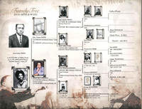 John White's Family Tree
 John White's Family Tree from his Family History book in 2003. The family Tree list a lot of people who are or could be buried in St. John's Cemetery or involved in the community.
-
 John D. White Photograph of Parents
 John D. White's parents; John M and Matelda White provided by John White in his Family History Book 2003
-
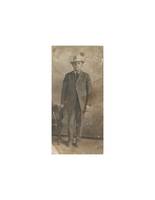
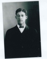 John D. White Photograph
 This is a photograph of John D. White was provided by John White. From his Family History Book in 2003.
-
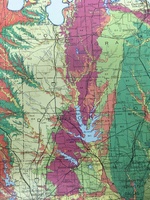 North Texas Soil Map
 This map shows the different types of soil that make up the region of North Texas. The Eastern Cross Timbers region is denoted by dark pink. This is where Pilot Point, Texas is located and most of the St. John's community lived. The cotton-growing land, located in the Blackland Prairies, is denoted by dark green.
-
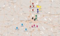 CME Church Circuit Map (1883)
 This map shows the CME church circuits of North Texas, which were identified after the Northwest Texas Annual Conference convened/
-
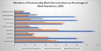 Chart of African American Church Membership in the South, 1890
 This a chart of African American Church membership in the South, in 1890. The AME, AME Zion, and the African American Baptists church denominations are measured.
-
 Major Cheney
 Photograph of Major Cheney
-
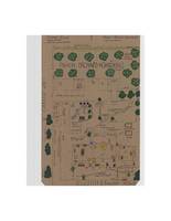 Hand Drawn Map of Cheney Family Farm
 This is a hand drawn map of the Cheney residence, and it gives a basic idea of what the layout of the farm was.
-
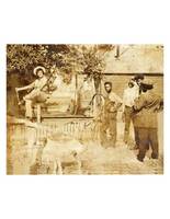 Cheney Family Picture
 Photo of the Cheney family at the Cheney residence. It is the only photo of the property before it burned down in 1946.
-
 Value of Manufacturing Input and Output
 Chart depicting the value of manufacturing input and output in Denton County according to compiled census data.
-
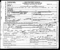 John D. White Death Certificate
 This is the death certificate for John D. White. The birth date on the record was unfortunately wrong according to other records, but the death year is correct. He died of pneumonia in 1910.
-
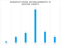 Manufacturing Establishments in Denton County
 Chart depicting the number of manufacturing establishments in Denton County according to compiled census data.
-
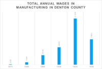 Total Annual Wages in Manufacturing
 Chart detailing the total annual wages in manufacturing in Denton County according to compiled census data.
-
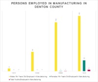 Persons Employed in Manufacturing
 Chart depicting the number of persons employed in Manufacturing in Denton County according to compiled census data.
-
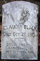 Claudia Black Tombstone
 This is a picture of the Claudia Black's Tombstone. Its purpose is to show a visual similarity of the Templars isignia's from one chamber to the next.
-
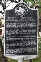 Shelton's Bear Creek Cemetery
 Picture of the historical marker at the Shelton's Bear Creek Cemetery which is where members of the Bear Creek community have been buried.
-
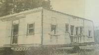 Mosier Valley School
 Picture of the abandoned Mosier Valley School building before it was moved in 1984.