Sante Fe Railroad Map
Item
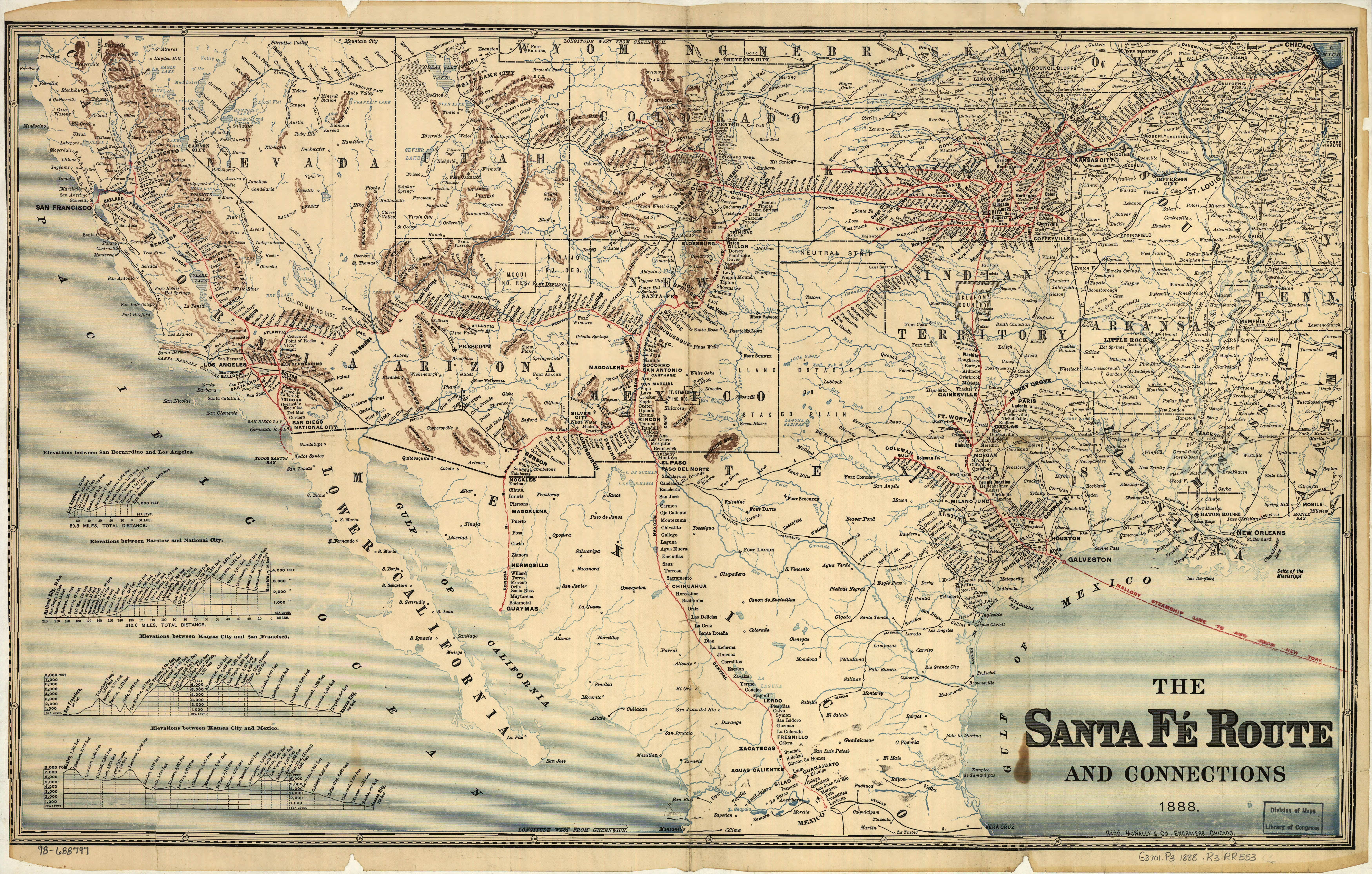
- Title
- Sante Fe Railroad Map
- Description
- Map of the Sante Fe Railroad Map in 1888, which extends through Texas.
- Date
- 1888
- Source
- Rand Mcnally And Company, and Topeka Atchison. The Santa Fé Route and connections. Chicago, 1888. Map. Retrieved from the Library of Congress, https://www.loc.gov/item/98688797/. (Accessed April 10, 2018.)
- Subject
- Map, Railroad
- Item sets
- All St. Johns Items
- Media
 Map
Map