-
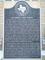 I.M. Terrell High School Historical Marker
 In 1882, the Fort Worth school system opened its first free public school for black students, called "East Ninth Street Colored School." It was moved to the corner of East Twelfth Street and Steadman in a property trade with the Fort Worth and Denver Railroad in 1906, and renamed "North Side Colored School No. 11." Isaiah Milligan Terrell was named principal and served until 1915. A 1909 bond election provided funds for a new building, which opened in May 1910. In honor of its former principal, the school was named "I.M. Terrell High School" in 1921. The school at twelfth and Steadman became a Junior High and Elementary in 1938, when Terrell High School was moved to its present location at 1411 E. 18th Street, site of a former white elementary school. Isaiah Milligan Terrell was born in Grimes County in 1859. Named one of the first four black teachers in Fort Worth in 1882, he served as principal and supervisor of black schools. He was married in 1883 to Marcelite Landry, a respected music teacher. Terrell became President of Prairie View State Normal and Industrial College (now Prairie View A&M University) in 1915, and later became an active leader in Houston's black community. He died in 1931.
-
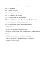 Oral history log of Winston Bruce's interview
 A log detailing the times and topics he discussed in his interview.
-
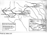 Butterfield Overland Mail in Texas
 The Butterfield Overland Mail opened for use in 1857 which brought an influx of settlers from Little Dixie.
-
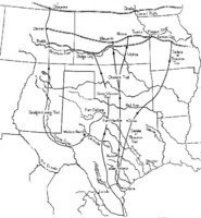 Cattle Trails to North Texas
 The Shawnee Trail (Texas Road) provided a new path from Little Dixie to North Texas following the Mexican American War.
-
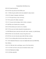 Oral history log of Yolanda Harris' interview
 A log detailing the times and topics she discussed in her interview.
-
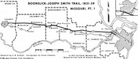 Boone's Lick Trail
 Map depicts the Boone's Lick trail which carved through central Missouri and stopped in Fulton, less than two miles from the location where the Davis family settled.
-
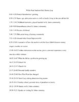 Oral history log of Willie Pearl Jackson's interview
 A log detailing the times and topics discussed in her interview.
-
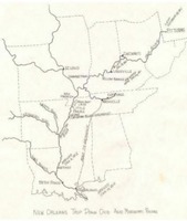 Six Months from Tennessee River Map
 Map shows the navigable rivers by which explorers migrated south prior to established trails which ran directly to North Texas.
-
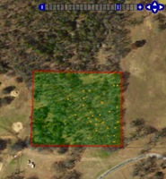 St. John's Cemetery Map
 This is a map of St. John's Cemetery. It marks the location of all known headstones in the cemetery.
-
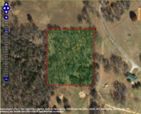 Aerial View of St. John's Cemetery
 This is a satellite image of the plot of land on which the cemetery is located.
-
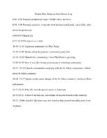 Oral history log of Pearlie Mae Simpson's interview
 A log detailing the times and topics discussed in her interview.
-
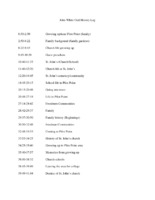 Oral history log of John White's interview
 A log detailing the times and topics Dr. White discussed in his interview.
-
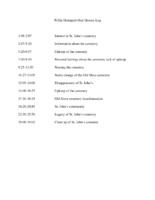 Oral history log of Willie Hudspeth's interview
 A log detailing the time and topics Willie Hudspeth discussed in his interview.
-
 Oral history interview of John White
 Interview of John White, a native of Pilot Point.
-
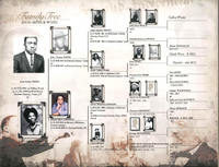 John White's Family Tree
 John White's Family Tree from his Family History book in 2003. The family Tree list a lot of people who are or could be buried in St. John's Cemetery or involved in the community.
-
 John D. White Photograph of Parents
 John D. White's parents; John M and Matelda White provided by John White in his Family History Book 2003
-
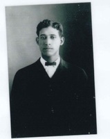 John D. White Photograph
 This is a photograph of John D. White was provided by John White. From his Family History Book in 2003.
-
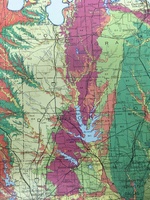 North Texas Soil Map
 This map shows the different types of soil that make up the region of North Texas. The Eastern Cross Timbers region is denoted by dark pink. This is where Pilot Point, Texas is located and most of the St. John's community lived. The cotton-growing land, located in the Blackland Prairies, is denoted by dark green.
-
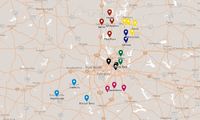 CME Church Circuit Map (1883)
 This map shows the CME church circuits of North Texas, which were identified after the Northwest Texas Annual Conference convened/
-
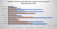 Chart of African American Church Membership in the South, 1890
 This a chart of African American Church membership in the South, in 1890. The AME, AME Zion, and the African American Baptists church denominations are measured.
-
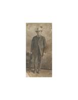 Major Cheney
 Photograph of Major Cheney
-
 Hand Drawn Map of Cheney Family Farm
 This is a hand drawn map of the Cheney residence, and it gives a basic idea of what the layout of the farm was.
-
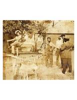 Cheney Family Picture
 Photo of the Cheney family at the Cheney residence. It is the only photo of the property before it burned down in 1946.
-
 Value of Manufacturing Input and Output
 Chart depicting the value of manufacturing input and output in Denton County according to compiled census data.
-
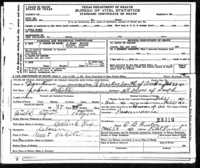 John D. White Death Certificate
 This is the death certificate for John D. White. The birth date on the record was unfortunately wrong according to other records, but the death year is correct. He died of pneumonia in 1910.